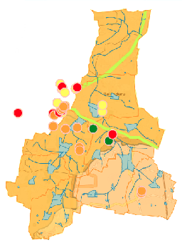
Is digging another borewell in my layout a good idea ? How deep should I dig? How quickly will my borewell dry up? Aren’t we all familiar with these types of questions? Many of us have also gone through the agony of seeing our borewells go dry. If only there was a way to be better informed while making these decisions. The good news is that we can be better informed. To understand our wells and borewells we need to understand : where the groundwater resides, how it flows, how much of it is there, what the connections are between our lakes & our borewells, and everything else we do on the surface that affects our precious sources of groundwater –
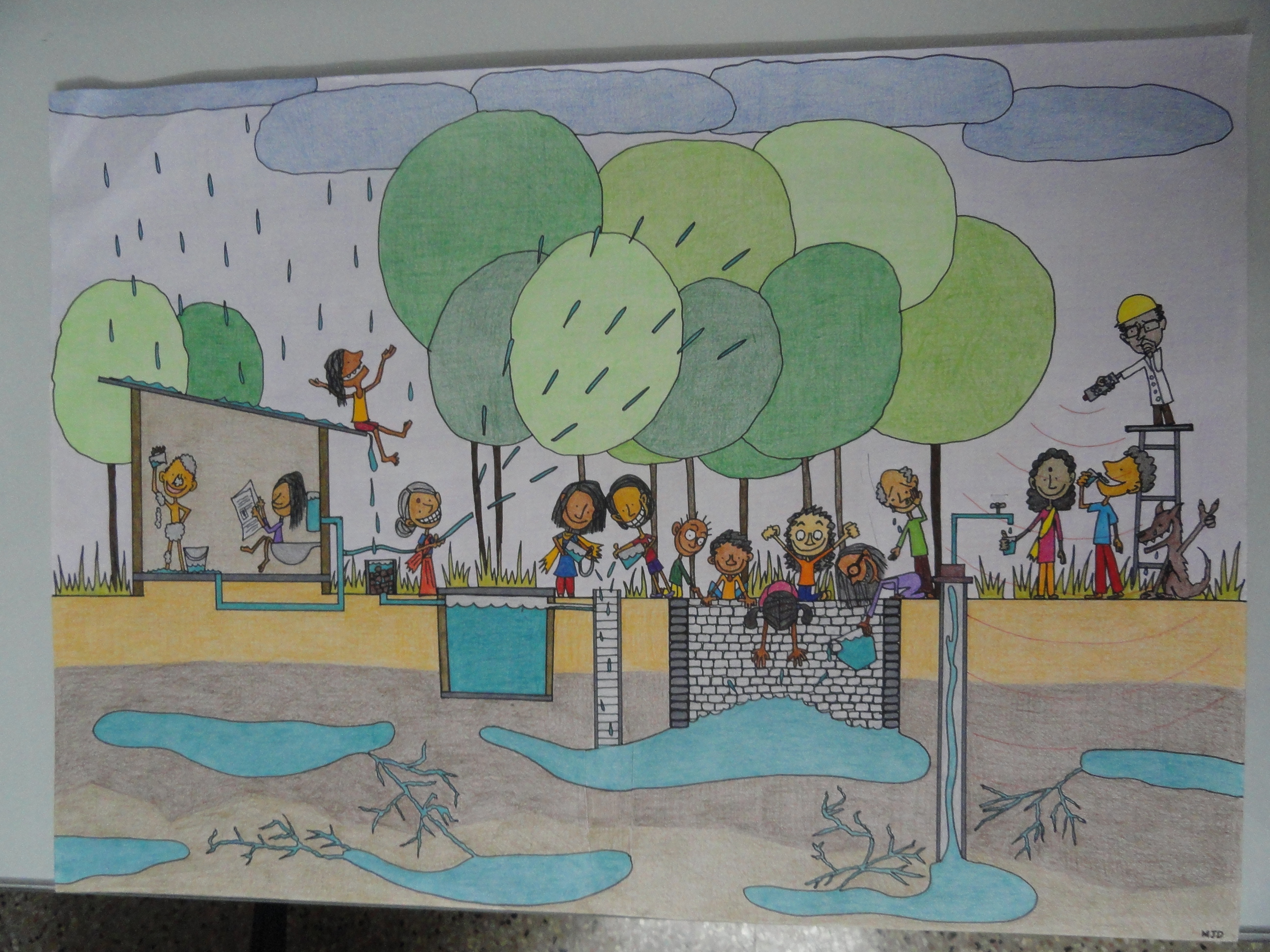 we need to understand our aquifers where this groundwater resides and flows. We can understand all of these if we share stories & information about our wells, borewells, how we use our water and how we throw our wastewater. Our individual stories are small pieces of a jigsaw puzzle. When we put all of it together - with the help of hydrogeology, the science of groundwater - we get a complete picture of our aquifer. Like none of us are owners of a river or a lake we don’t own our aquifers either. It is our common resource – we can’t see it but we can map it and answer many of our questions to collectively manage it.
So come here and share your water story. Share data about your wells and borewells. Share your questions, share your experience. Wipro, Biome Environmental Trust, ACWADAM and Mapunity have put this platform together to facilitate this sharing and to help us map our aquifers. And we can together find answers to all those difficult questions about our wells and borewells. This platform will continuously evolve with your inputs – if you have ideas on what this platform should have or specific views or questions, please drop an email to shubha@biome-solutions.com
 |
 |
 |
 |
